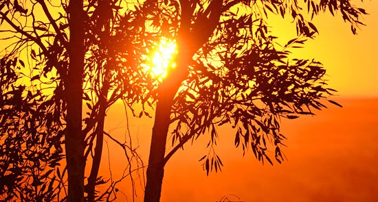
While much of the country swelters through a nasty heatwave, the official 2012 weather report has been delivered. And on the surface it was a pretty average year, with average rainfall and slightly above average temperatures. But averages don’t reveal the true story.
A wet and cold start to 2012 was counteracted by a hot and dry finish, leading to nationally averaged rainfall 11mm above the 1961–1990 mean of 465mm and temperatures 0.11 degrees above the average, the Bureau of Meteorology found in its annual Climate Statement. The degree of variation in rainfall is shown starkly in the below graph, with March nearly doubling the average, while the following nine months saw below average readings for all bar June.
All in all, it was Australia’s 40th wettest year out of 113 on record. It follows the most sodden two-year period in recorded history. The Bureau said the wet conditions early were consistent with a moderately strong La Nina event, while “El Nino-like” conditions took over mid-year.
The influence of extremes is a key talking point, with maximum temperatures on the rise and minimums on the decline. While overall average temperatures lifted 0.11 degrees, maximums were 0.51 degrees above the mean and minimums 0.28 degrees below — a discrepancy only bettered twice in 113 years.
From hot spells to floods, extreme weather events were felt across the country, most noticeably:
- Flooding in the east of the country due to “one of the most extreme multi-day rainfall events in southeast Australia’s history”. This brought daily rainfall totals between 50 and 100mm over a broad area of northern Victoria, southern New South Wales and eastern South Australia.
- The second hottest August-December period on record — 1.58 degrees above average across the country.
- One of the most significant spring heatwaves on record across much of eastern Australia at the end of November. Ouyen in Victoria’s Mallee hit 45.8 degrees on November 29, a new Victorian record high for spring. The old record — set in November, 1980 — was also broken by Mildura (45.5 degrees), Hopetoun (45.0), Swan Hill (44.8), and Walpeup (44.7). November 29 is now the benchmark as Victoria’s hottest spring day.
- The highest NSW temperature for spring was 46.2 degrees at Pooncarie (fourth-highest ever November maxima for the state), while in South Australia, Oodnadatta residents sweated through the state’s warmest ever overnight November temperature (32.3 degrees).
- No rain was recorded at Alice Springs Airport in the 157 days from April 25 to September 28, the longest rainless period in the site’s 71-year history. Meanwhile the city had its equal hottest September and October days.
- Darwin saw its coldest August night — 13.1 degrees Celsius.
- Record-high monthly maxima were recorded in the Kimberley and Pilbara for August, in northeastern South Australia for November, and parts of the far northern coast for December.
The slightly warmer conditions overall for 2012 represented a turnaround from 2011, when cooler than average temperatures were recorded for only the third time since 1990.
Despite cooler conditions across 2010-2012 compared to recent norms, the last decade (2003–2012) has still been one of Australia’s warmest on record; with an anomaly of +0.44 degrees, the fifth warmest 10-year period on record. This figure is eerily similar to that of global temperature changes over the past decade — with 2003-12 the third hottest decade on record, 0.45 degrees above average, according to the World Meteorological Organisation.
As for what’s in store in 2013? The Bureau suggests the hot end to last year is set to extend well into this as La Nina will not be a factor. It’s early days, but with January on track to be one of the hottest months ever, the stage is certainly set for more unwelcome records in 2013. Indeed, early forecasts suggest it may be the globe’s hottest on record.
*This piece was originally published by Climate Spectator




Good thing all that carbon in the atmosphere is promoting all that plant life hey Rupert.
Early forecasts are that 2013 will be the hottest on record.
My forecast is that Tamas will soon write a comment noting that there has been 0.7 degrees Celsius of cooling from 1980 to 2012, starting with a warm peak in 1980 and finishing with a ‘cool’ period in 2012.
What do we tell the kids?
What do we tell the kids?
The same as always for the last 150 years or so.
If it’s not pissing down rain it’s going to be hot.
It is summer turkey.
.
Those Climate Change deniers who accept that warming has taken place point to sunspot cycles, solar minima/maxima, etc. as if the climate effects of these were understood. They are not, and while the detailed effects of proven anthropogenic changes to the atmosphere can of be predicted with certainty with respect to amount of warming or times scales. the effects are unlikely to be benign. A three degree warming is the difference between Sydney and Brisbane. So what? Well if rainfall patterns have a corresponding shift we lose most of the Wheat belt. A precautionary principle is I believe the only sensible approach to deal with what is almost certainly human-induced warming.